Monday, February 27, 2017

Forever Came And Went ... Goodbye South America ... Hello Panama Canal


South America has left the room ...


Status: Intense Travel Mode
Location Tonight: Panama City, Panama
Miles Traveled:  9,005
Estimated Time of Arrival (Oregon): March 22nd.
Altitude: Sea Level
Attitude: Good, Tired, but Persistent

---------------------------------------


We were in Cartagena, Colombia and took a tour of a giant fort on a hill in the city.  It is the largest fort built by the Spanish in the New World.  In other words, almost all of South America was conquered and settled by Spain, and this was their biggest effort (outside of Spain) to defend what they had. 

The reason?  Gold!  There was a tremendous amount of gold in the lands discovered - and taken - after Christopher Colombus showed up (Colombia was named after him).  


And they shipped most of the gold from Cartagena, Colombia back to Europe. 


And guess what?  Other people wanted that gold. What kind of people? ... Pirates!  There were a bunch of Pirates who were a pain in the neck to the Spanish.  So the Spanish built a great big fort.  It had big walls and cannons and ramparts and battlements and other fort descriptions.  It was a mighty fort with thick fortified walls meant to keep people out - they thought it would last forever!

Well, Forever Came And Went!


The fort lasted from 1530 to 1587, when the French arrived with big ships and bigger cannons, and bombed the hell out of the fort and destroyed it.  It took ten years to build ... and about a week to destroy.  Other hostile nations eventually showed up and sacked the place.  Spain eventually lost all their colonies.  

Lesson learned ... Walls don't last ...  You can't keep people out.   

The history of Latin America is complex and very interesting, and we have seen and experienced a great deal of it.  

And, now, in the last couple days, we have made the transition from South America to Central America - Panama!

-------------------------------------------


Full Disclosure:  Our original intent was to drive the entire way home from the bottom tip of South America (Tierra del Fuego) all the way home to Oregon.  Or at least, travel overland, on the ground.

But there is a small hitch in that plan - you can't drive all the way.  There is a gap between Colombia and Panama.  It's called the Darien Gap, and there are no roads.  It's a no-mans-land.  It's full of drug dealers, dangerous animals, deep jungle, missing people, swamps, disease, and other horrible stuff.  If you go there, you will likely never be seen again.  Look it up.  It's a thing.  

So even with the best intentions, you really can't drive all the way - so we flew - from Cartagena to Panama City, Panama.

------------------------------------------------


The Panama Canal 


You discover the most amazing things when you travel to far away places.  This country has a vibrant economy.  Panama City is a massive metropolis with high rise buildings everywhere and it's a modern big city.  

And it's right next to the Panama Canal.  Actually, maybe 10 miles or so, but close enough.  We went there today, and it was remarkable.  They are clever enough here to maximize the Canal as a place people want to visit, and we weren't disappointed.


There is a huge viewpoint over the canal where you can see the ships pass through the locks.  We were able to see three massive ships make their way through the canal, on their way from the Pacific to the Atlantic (or Carribean to be a little more precise). 

The story of the Canal is fairly epic.  The undertaking was a scale unknown up to that time, and a lot of workers gave their lives to the effort. The biggest reason was disease.  Working in the jungle and the tropics was rife with Malaria and Yellow Fever, etc.  They had to come to grips with that challenge in order to keep the workers healthy enough to complete the job. 


It's been over a hundred years since the Canal was opened, and it's functioning at peak performance, providing a major, significant, shortcut to ships making the journey from one ocean to another. 

---------------------------------------------

Outside of the Canal, Panama City is interesting in it's own right.   
We visited the impressive colonial old town, and saw some more statues of our old friend, Simon Bolivar.  This dude gets around.   


He was responsible for much of the Independence gained by several Latin American countries, one of which was named after him = Bolivia. 

Interesting fact:  Panama was once part of a large chunk of South America, known as Gran Colombia. It was comprised of Venezuela, Colombia, Ecuador, and Panama.  Obviously, it broke up into those separate countries. 

Bolivar was also active in the separation from Spain of Peru and Bolivia.  Among historical Liberators, he has a pretty impressive resume.

--------------------------------------------

It's also Carnaval (spelled correctly) time here in Latin America, which is the party time leading up to Marti Gras, when Lent starts and people get religious for the 40 days leading up to Easter.  It's a Catholic thing. 


I won't go into the story behind that other than to explain - "if I'm going to be holy and pious for 40 days before Easter - well, I'm gonna have a damn good time before that happens".  


Carnaval is probably biggest in Brazil, but the rest of Latin America puts their heart and soul into the celebration.   

The world is like a flower that just keeps blooming and blossoming and opening up and revealing new petals of joy ...


Another Point of View


Yellow on Yellow in Cartagena 


Butterflies in Panama


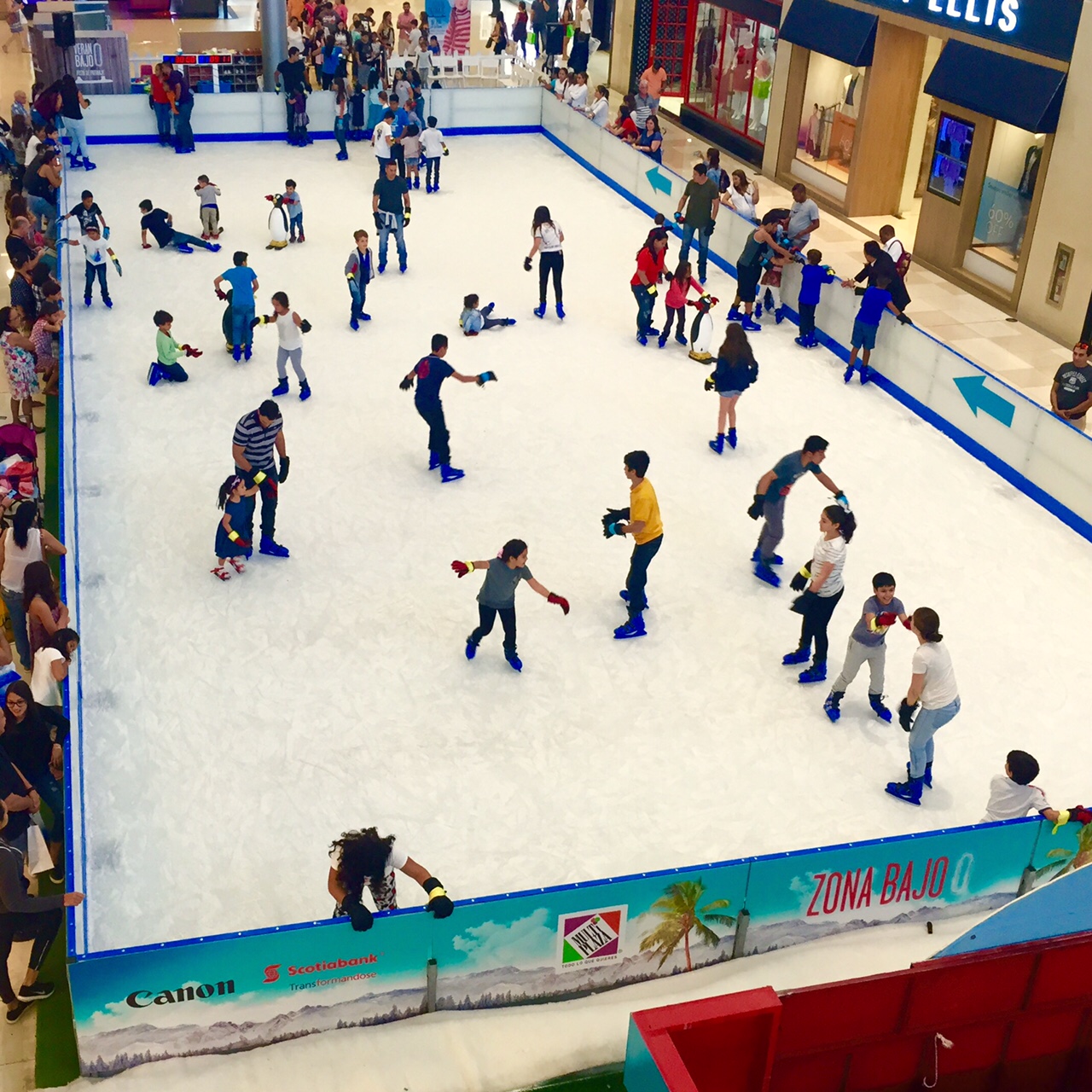
What?  A skating rink in Panama (it was in a mall)


Sunset over Panama City 


Thursday, February 23, 2017

Is This a Drug Lord's House? No, It's the Home of Our Liberator


Bogota, Colombia has been our most recent stay.   We're moving north ...


Trying to stay on schedule to get back to Oregon by March 22 or so.  It's been a challenge, but we are making progress!


Currency exchange is part of the game when you travel. 


One of the more confusing and challenging aspects of this trip through South America has been the different currencies.  So far we've had to get used to the following currencies (with more to come):

Chilean Pesos      = 675 to Dollar
Argentine Pesos   = 16 to Dollar
Peruvian Soles     = 3.25 to Dollar
Ecuador Dollars  = $1 is a Dollar
Colombian Pesos = 2,800 to Dollar

You may have noticed that Ecuador uses the Dollar, as in US Dollar bills, like greenbacks.  They even give you change in quarters, nickels and dimes. 

That was a much easier adjustment than Colombia, where a bowl of soup can cost you $23,800 - which is even more confusing because they use the dollar sign "$" to mark their currency.  All the Latin American countries use that symbol for their currency.   

We've had to be pretty clever to adapt to the different exchange rates, especially in relation to things like buying gas or diesel for the rigs we are driving.  For example, most Latin American countries use metric liters for measuring gas, but some like Peru and Ecuador, use gallons.  

So you get sticker shock when you try to convert liters (in Chilean Pesos), into gallons (in US Dollars). It gets real tricky. 

And food is crazy too.  You are never quite sure what a bottle of water costs (unless you are in Ecuador, where you pay in Dollars).  And getting the correct exchange rate is always a game, with foreign exchange agents always trying to get one over on you. 

Just arrived in Cartagena, Colombia 


We have really enjoyed our time in Colombia.  This place is great, and seems very peaceful and quite prosperous, at least in Bogota (pronounced Boh-guh-TAH).  This is a modern country with handsome people wearing stylish clothes.  

The weather is great and the food is good.  They have a sense of style and a spirit of enthusiasm, and - surprisingly in South America - they are courteous drivers!


Speaking of driving, I wanted to give an update on some recent news here.  A bus in Argentina recently crashed on a dangerous mountain road in the Andes - the kind we were driving on for six weeks!

It was real close to where we recently crossed the mountains between Chile and Mendoza, Argentina. A bus lost control and plunged off a cliff and 19 people died!  Yikes, this hits home!  A reality of driving in South America is that the roads can be treacherous and lethal.  

Peru, in particular, has a dreadful history of fatalities on the roads.  I'm glad we're done with that part of the trip.


Visiting Bogota, a very scenic city.


After visiting the Montserrate (below), a mountain church that soars above the city, we went to visit what Fiona and I thought was a drug lord's house.  I thought our driver said it was Pablo Escobar's house. 

What are we doing visiting a drug lords' house, especially in the middle of the city?  Only we were mistaken!  Oops!  It was the home of Simon Bolivar, the Liberator of much of this region of South America!


Ha! Ha! You better get your history straight or who knows what you'll find yourself involved in ...

---------------------------------------------

Another pleasant surprise - Awesome Food Carts! Bogota is getting hip, they had some super cool food carts, just like Portland, and the food was delicious!
 
---------------------------------------------


When most people think of Colombia several things come to mind. I won't list them but most of them are - shall we say - not good.

But we have seen no evidence of that (well, actually, a bomb did go off in Bogota when we were there).  In fact we have enjoyed our time here, especially in Bogota and now Cartagena.

The country seems to be progressive, modern, organized (in a Latin America sort of way), and relatively affluent. It's clean and colorful. There is a lot to see and do. It's pretty lively.  And, as you can see, the mountains tower over everything.  


One of the more enjoyable visits was to the top of Montserrate in the hills above Bogota. 


The view if the city was fantastic and the weather was perfect.  And to get there you ride up in a vertical train called a funicular (remember this from Valparaiso, Chile) and to come down - you go in a cable car - great fun!


The views at the top were stunning.  Bogota is a huge city, with more than ten million people. Another one of those mega-cities.  You could see most of it from the mountain vantage point.


We also visited what they call the Gold Museum. 


It's filled with countless, precious, and priceless artifacts. Hard to comprehend, seeing that much gold in one place, most of it ancient from pre-Inca days. The country is (was?) full of gold, so much that in the old days they used it like we might use steel or tin or aluminum.

The picture at the top of the blog is a solid gold mask used by the ancients.  And the picture below is a large (symbolic?) image of a jaguar.  Again, solid gold.  


Now in Cartagena (prounced Car-Ta-HEY-Nah); we have reached the northern tip of South America. In fact, we are currently on the Caribbean Ocean, no longer on the Pacific side, where we've been the last two months.

Another big change, we're at sea level!  We're two blocks from the ocean. This is a big change from the massive Andes Mountain range - where we were at (or above) ten thousand feet for pretty much the last three-and-a-half weeks.

One last souvenir of Bogota: I desperately needed - and finally got - a haircut. You may have seen the picture.  Always a risky proposition in a foreign country.  It was not my idea of style ... although, what is my idea of style?

Another Point of View


This picture was taken from our hotel in Bogota. Frankly, looking down this flight of stairs made me kind of dizzy.  But it made for a cool picture. 


And of course, the obligatory sunset - this time over Bogota.  This being a big city, the view was somewhat obstructed by a building. 


Sunday, February 19, 2017

Make Up Your Mind - North or South? ... The Equator


The Equator is a big deal.  

Big enough to name your country after it


One of the activites that is popular in Ecuador is to visit the Equator.  The line runs right through the city.  And they named their country after the landmark, using a variation of the French spelling. 

They call this place "The Middle of the World" or the "Center of the World".  This is kind of significant for us because we started our journey at "The End of the World" - in Tierra del Fuego at the very southern tip of South America.  

That was almost eight weeks ago.  We have made steady progress and have now officially passed over into the Northern Hemisphere.  Another few days and we will have traversed the entire South American continent. 

To establish the line of the Equator was a big deal back when it was unknown (think about it - it's more of a concept than a place).  The French, in a big show of commitment, sent a team of scientists here about 200 years ago.  Why here?  Why, in what has become modern day ... Ecuador? 

Well, most of the Equator lays in the ocean. Since (we were told) you can't get reliable measurements for triangulation (a necessary element to compute locaton) in the ocean, you need high ground.  There is certainly a lot of that in the Andes Mountains around here.

The French made tremendous strides in marking the line, and it has stood the test of time.  It is also remarkably close to the place that the indigenous natives had established about 2000 years ago.  


We enjoyed our time at the Equator "park" and took the obligatory picture with the line in the middle.  In this case, Fiona was on the right, in the Northern Hemisphere, and of course, there's Kevin in the Southern Hemisphere.  


And of course, the actual line is a source of some controversy.  Around twenty years ago, a new group of scientists showed up with GPS to confirm the precise location and guess what?  They found it about two hundred yards away.  Talk about nitpicking!  The French didn't use GPS and the ancient indigenous folks, well, they just used the stars ...

And the huge monument at the top of this blog post is where the Equator was traditionally marked. When the Johnny-come-lately GPS guys showed up, the reaction was ... "Hell, we ain't moving that big freakin' monument!"  So it stays where it was.  

And on a hill top not far away is the ancient pile of stones that the unsophisticated but highly accurate ancestors used to mark the spot.  So there are three "official" markings of the Equator.  Life is full of choices!


Quito is a special place


There is a spectacular Basilica in Quito on top of a hill that towers above the city.  It is magnificent.  It was a recommended visit point from a close friend of ours who has spent a lot of time here. 

He said, go and visit and climb to the top if you're brave enough.  So I accepted the challenge and well, let's just say my fear of heights kicked in and ... I had to pass on the last fifty feet on a rickety metal ladder wet from the rain ...


Like I said, we gotta keep movin'


So tonight we find ourselves in Bogota, Colombia. We arrived with enough time to take a visit to a important spot, the amazing Salt Cathedral.  It's a very large cathedral carved into the middle of a salt mine, inside a large hill. 


This salt mine has been around for quite some time, and was put into commercial use around the year 1800.  The entire hill contains a high degree of salt, which they dig out in big tunnels. 

The miners, in an effort to appeal for safety and protection in the tough environment, carved out a religious site and we got to take a tour.  It was really elaborate and we walked around inside for a couple hours.  


It was filled with statues and religious icons and is highly valued by the local Colombians. 


Another Point of View


This is where I put in some miscellaneous pictures that may or may not be related to the stories above. 


This picture above was near the Equator and is in the crater of a volcano.  You can see by the farming that they don't expect it to erupt any time soon. 


A group of school kids in Quito, on a tour with the local guide, the guy in the hat who is in costume.


The Salt Cathedral was in the town of Zipaquira, which has a picturesque Church above ground too. 


Gotta have that sunset picture - this was our last evening in Quito Ecuador.

Friday, February 17, 2017

The First Dead Body on the Trip - And You Get High and You Stay High

Cuenca was a beautiful city, but our time there was short.


Moving along quickly now, with major miles covered since leaving Peru


We are well into our trip through South America and have gained some serious mileage in the last few days.  At this point in time, we have switched over from driving ourselves to bus trips across borders and through the mountains. 


There have been a number of what we call "one-night-stands" where we drive and push hard to get to one town, only to spend a single night there and keep moving, repeating the same pattern the next day.  

The last few days including many "one night stands" and we need to re-think this strategy.  This kind of travel can be draining.  You never get to unpack your bags, and it often does not allow a more in-depth visit to many places. It's important to find a balance.  


We left Piura Peru and crossed over into Loja Ecuador on Tuesday February 14th.   That's of course Valentines Day, and we were surprised to find out that Loja celebrates in a big way! There were parties everywhere, including our hotel, and the streets were filled with people.  

Everybody was dressed up and lively and we certainly did not expect that.  I would have to say that this was the most enthusiastic expression of Saint Valentines Day that I have ever seen.  

---------------------------------------------

Traveling by bus is enjoyable for two reasons:  
One - we aren't driving, which had become rather exhausting and frequently tense with the treacherous mountain roads.
Two - the scenery has turned a beautiful green after weeks of dry hot landscape.  As a passenger, I could sit and gaze out the window at the scenery.  In comparison, the Peruvian coastline was maybe not the most fun place to drive.  

We covered over 1,750 miles in Peru.  We enjoyed the country, especially places like the Nazca Lines, Arequipa, and Cajamarca.  But much of the drive was on poor, cliff-hugging roads or desert sand.

I did see my first dead body (so far on this trip) in Piura Peru, our last day there  


For many years, as long as I can remember, I start out everyday by going jogging.  This trip has been no exception.  It's a great way to stay in shape and you get to see the town and get oriented.  

On that morning, I was running along the river in Piura, which is quite a nice town.  The river is pretty full from recent heavy rains in the Andes.  As I made my way down the riverbank, I saw a crowd of people up ahead.  "What's going on?" I thought to myself.   

As I grew closer to the cluster of people, I could see they were milling around, quiet and somber. When I got up to the crowd I slowed down to make my way through, and that's when I noticed the body laying on the sidewalk, covered in a sheet.  It was obviously a dead body. 

I tried not to stare.  It was not a pleasant site. My only conclusion was that it was pulled from the river below.  Like I said, there were some very heavy rains that had wreaked havoc further up in the Andes, and there were a few fatalities reported. I presume this was a casualty of that?  

Out of respect, I walked for a couple blocks before I resumed running.  It seemed like the right thing to do.  I couldn't just trot off like nothing happened. 


---------------------------------------------


The terrain is different now in Ecuador


We have made the transition from the rugged rocky mountains of northern Chile and Peru, into the verdant, green mountains of Ecuador.  This place is like an explosion of green compared to the sand scape we've been passing through.  However, the majestic mountains were no less impressive.


The altitude in Loja (pronounced Low-Hah) is around 7,500 feet above sea level, and once you get up that high in Ecuador, you stay there.  It seems like the whole country is a big giant mountain range.  Part of the time, you're driving in the clouds. And, amazingly, they farm the mountain sides.  

We took the bus to Cuenca (altitude 8,500 ft), and rode across the top of the mountains all the way. 
It was a spectacular drive. 


Tonight, as I write this, we have arrived in Quito (pronounced KEY-Toe) - the capital of Ecuador, with an altitude of nearly 10,000 feet.   It's raining hard.  Places don't get this green without a lot of rain.  

Quito is right smack dab on the equator.  It's a very historic town and we look forward to exploring this area. We will soon pass into the Northern Hemisphere.  

Although you wouldn't describe it as such, Ecuador is the smallest country we've been to, compared to the other places we've been.   But it's really beautiful.  And the people are friendly and very interesting.  It's a surprisingly well-developed place.


Our time here will be relatively short, with a pressing time schedule still ahead to get back to Oregon.  You have to make trade-offs when traveling; you simply can't do everything. I already regret that we can't spend more time here. But we have to keep moving.  


 Another point of view


The folks here have a distinctive way of dress, especially the women.  They all wear colorful clothes and hats, usually with a long braided ponytail.  I was able to capture this picture below from the bus window, while she was talking on her cell phone!


And here's another 


Monday, February 13, 2017

Deceit and Murder In The Land of the Incas - Two Miles High

The last couple days were spent high up in the Andes, in the home of the Inca civilization.


After driving miles and miles along the Peruvian coastline for several days, we took a journey back up into the Andes to a city called Cajamarca.  It was another serious mountain road, and we climbed from sea level all the way up to 10,500 feet.  At one point we were in the clouds it was so high.  The views were spectacular.


At times it seemed like we were going straight up, climbing a thousand feet every ten minutes.  The good thing was that with our new geographic location, we are much closer to the equator and everything is starting to get green again.  

In fact, the roads were in bad shape from recent heavy rains. 


We have been passing through desert-like rocks, hills, and sand for several days, and it has been dry and rather desolate much of the time.    But now we are back into more lush landscape, with lakes and rivers, even a few waterfalls. 


Cajamarca (pronounced Cah-hah-mar-kah) is an ancient city sitting at the top of the Andes, and it's not easy to get to.  There were more hair raising mountain roads with enormous drop offs and of course - no guard rails half the time.  


This is the home of the Incan civilization, a huge empire that spanned several hundred years and a huge swath of South America.  It all came to screeching halt when Pizarro showed up with his mercenary Spanish army, and killed the Incan ruler, Atahualpa.  It all happened in Cajamarca.

We went to visit various historical sites, and even saw the infamous room where the Spaniards held the Incan ruler for ransom, then double crossed him and killed him.  This has left some bad blood to this day, for obvious reasons.  There are a lot of remnants of the Incas to this day. 


--------------------------------------------

The story is told that the ruler Atahualpa said as a ransom, he would fill a room up to a mark on the wall as high as he could reach, with gold.  Since the vast Inca empire had a lot of resources and precious metals (there's gold in them thar hills), they were able to meet this demand.  But the ruthless Pizarro killed the ruler anyway for trumped up reasons.  


It wasn't long before the Spaniards took over the area and renamed it Peru.  Pizarro was later put to death in a revenge killing, but died a very rich man. 


A lot the Incan history is visible in Cajamarca.  But you better be in good shape, it's not easy walking around or doing much of anything at 10,000 feet high.  It takes some getting used to.  But the weather was good and we enjoyed it there a lot. 

There is a lot of indigenous tradition around, like the two musicians below, playing a super long alpine type horn that echoed off the walls of the valley.


One of the places we visited was an ancient carving called the Ventanillas. It was an amazing evidence of the skills of the people here over a thousand years ago.


Tonight we are in Piura, and our time in Peru is coming to an end, as our next stop is Ecuador.  


One last Point of View


I have decided to post a picture now and then that doesn't really have a connection to the theme of the blog, but is interesting nevertheless.  This scene below was on the road from Chimbote, when we saw perhaps the most overloaded truck we have ever seen.  Of course, it was broke down as shown by the guy with his head under the hood.